StreetWorks SDK
Python · open source, MIT licensed · PyPI · GitHub
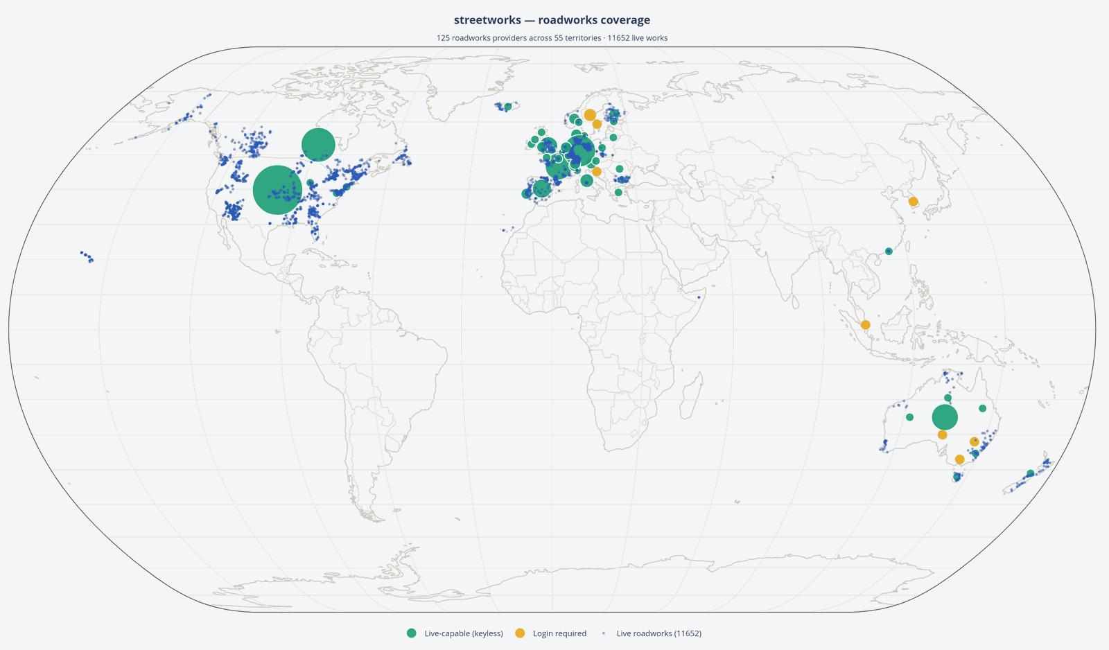 A partial live pull through the SDK, August 2026. Each blue dot is a works site.
The problem
Roadworks and street works data is published by hundreds of separate authorities around the world, in inconsistent formats, on endpoints that change. Anyone wanting a wider picture has to write and maintain bespoke handling for each one — working out how a given country’s infrastructure works before they can start on the actual problem.
What it does
StreetWorks SDK normalises data from over 130 official sources worldwide into one consistent model, so the source of a record stops mattering to the code consuming it.
pip install streetworks
Two systems that share no schema, no standard and no language — the United States (WZDx) and Spain (DATEX II). Run each through its converter and the same caller code handles both, unchanged:
from streetworks.common import from_datex2, from_wzdx
from streetworks.datex2.dgt import DGTClient   # Spain (DATEX II)
from streetworks.wzdx import WZDxClient        # USA   (WZDx)

with WZDxClient() as wzdx:
    feed = wzdx.fetch("https://wzdx.wsdot.wa.gov/api/v4/WorkZoneFeed")
us_works = from_wzdx(feed.road_events, territory="USA",
                     administrative_area="Washington")

with DGTClient() as dgt:
    es_works = [from_datex2(s, territory="Spain") for s in dgt.iter_roadworks()]

# Two unrelated standards — now the same shape.
for works in [*us_works, *es_works]:
    for site in works.sites:
        print(works.territory, site.works_type, site.date_confidence)
Discovery works the same way. Ask what covers a territory and each result prints its scope, whether it needs credentials, and the exact import line to use next — so there’s no hunting through docs to reach a given feed.
Design notes
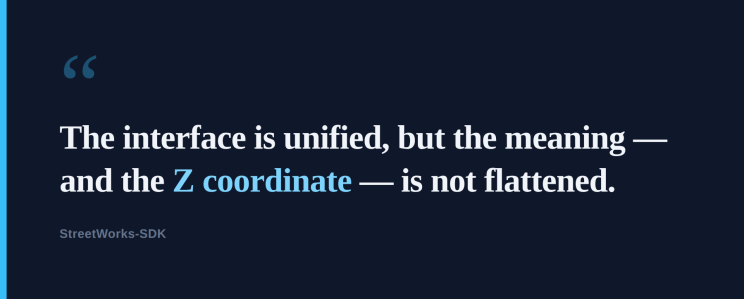
The common model doesn’t flatten the source. Every record keeps its
untouched original on .raw. You reach for the same field names whichever
provider it came from, but the native structure, language and any extra
richness stay accessible underneath. Norway carries Z coordinates in its
national road-link geometry; a common model that discarded that would be
throwing away something real.
Gazetteers are first-class, and split correctly. An address register answers “where is this address?”; a street register answers “what and where is this street?”, with geometry. Conflating them produced a genuine analytical error early on — “European gazetteers have no street geometry” looks true if every example to hand is an address register, and it’s false. The geometry lives in the street register, usually published by a different body entirely.
Never silently reproject, always label the coordinate system — and the same discipline applied to the vertical axis. Elevation is carried as a named provider’s stated value with its vertical datum labelled as carefully as its CRS, rather than assuming two sources agree because they happen to.
Full detail in the common model docs.
Coverage
138 providers currently registered, 103 of which need no credentials at all. Roadworks and streetworks feeds are the focus, with street gazetteers as the necessary companion — plus Digital Traffic Regulation Orders, the modelled NUAR API, and the UK Police Crime API.
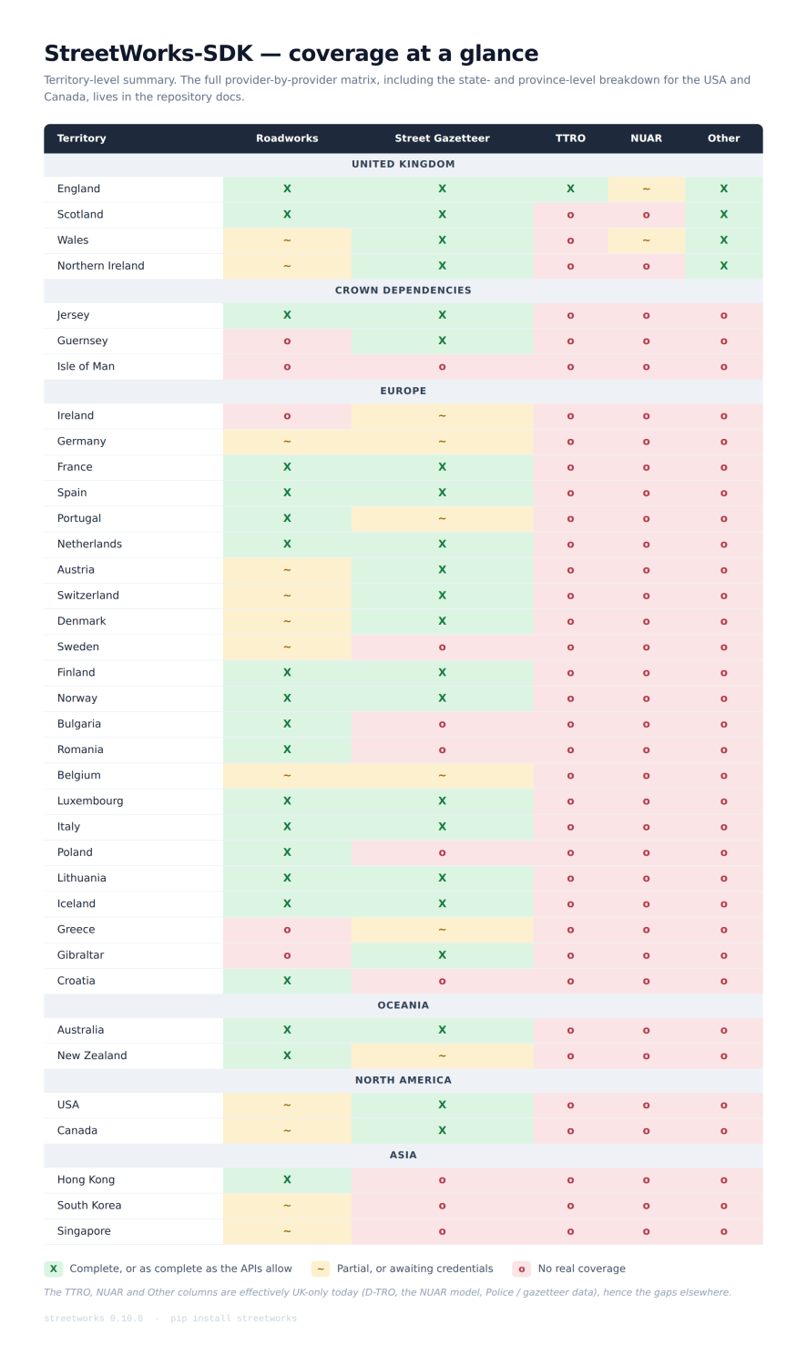
The full provider-by-provider matrix, including state-by-state and province-by-province breakdowns for the USA, Canada, Germany and France, is in the repository docs.
What it turned up
Building it surfaced something I didn’t expect. Plenty of countries publish a national roadworks feed — the road authority describing what it’s doing on its own network. Very few run a national roadworks register: the statutory system where anyone wanting to dig has to apply, and an authority grants or refuses it. Of the national systems reachable so far, only England’s Street Manager, Scotland’s SRWR and Jersey’s RoadWorkx qualify. Most good permit registers are single cities working in isolation.
England has a complete, joined-up national stack — register, gazetteer and legal traffic orders, all reachable through one interface. That turns out to be genuinely rare.
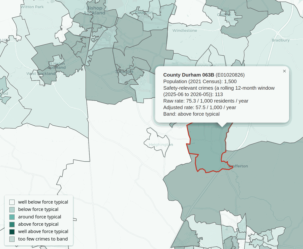
Full write-up
I set out to connect England’s streetworks systems. I ended up mapping a third of the world’s. — the standards, the surprises, the Section 50 aside, road worker safety, and what building it taught me about how fortunate England is.
Status
Current version 0.10.0, and a genuine work in progress. NUAR is modelled but not live, several feeds are waiting on credentials, and there are whole countries not yet reached.
A personal project, built in my own time and separate from my day job. The original idea came from a conversation with Christopher Carlon; pull requests from Christopher and Jamie Atkinson have gone in since.
If you maintain a feed that should be in here, or you’ve built something on top of it, I’d like to hear about it.